


[Publicidad]


During the first few minutes after an earthquake, there is usually a vacuum of information in which authorities are unable to determine which sites were most affected or whether or not there has been structural damage in large buildings.
This is why the Seismic Engineering Coordination at UNAM’s Engineering Institute is working on generating maps to measure seismic intensity and the overall damage throughout the national territory in real time, which could ultimately improve decision-making during times of crisis.
In order to generate these maps, Mexican scientists use information provided by several institutions such as the National Seismologic Service , operated by the Geophysics Institute .
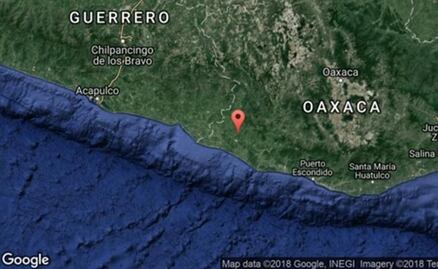
The national coverage is very diverse, though it is focused on Guerrero and Oaxaca , where the Engineering Institute is operating a monitoring network. Coverage is more deficient in the north-east.
When a tremor occurs, the mapping process is instantly triggered to identify whether or not there has been an earthquake and, according to its acceleration, the system determines whether or not a map should be generated.
dm
[Publicidad]

[Publicidad]
Más información

Nación
Segundo Informe de Sheinbaum presenta avances en política de cero corrupción; destaca 4 mil sanciones a funcionarios

Espectáculos
Cinco documentales de true crime en Netflix y por qué verlos

Metrópoli
Alcaldía Cuauhtémoc rehabilita cancha de Futbol en Tlatelolco; recuperación de espacios públicos continuará: Alessandra Rojo de la Vega

Tendencias
¿Cuánto cuesta la Barbie Día de Muertos 2026?; así es el nuevo lanzamiento de Mattel