Más Información

Cae jefe operativo del CJNG, junto a 13 presuntos secuestradores en Veracruz; liberan a una persona privada de su libertad

¡La ropa! Activan alerta amarilla por fuertes vientos para esta tarde en CDMX; rachas podrían alcanzar los 59 km/h

Presidencia lanza convocatoria para segundo encuentro continental de youtubers; en 2024 gritaron porras a AMLO

Joven trabajador de una obra en Tláhuac termina con barreta incrustada en el rostro; es trasladado en helicóptero a un hospital
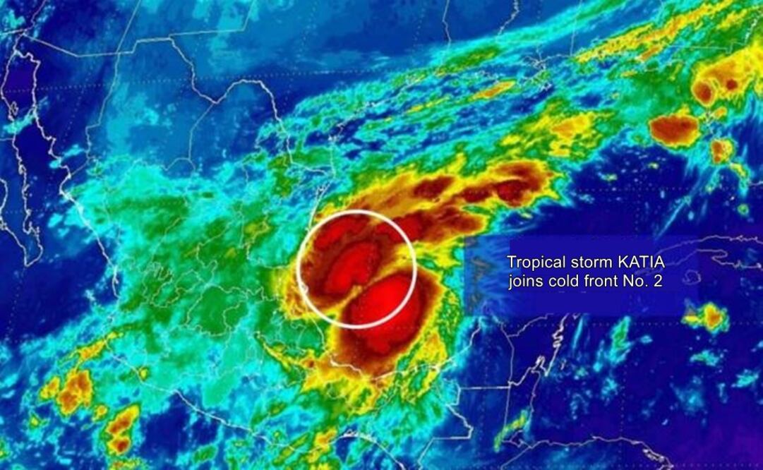
The Mexican Meteorologic Service Organization , in coordination with the National Hurricane Center in Miami, Florida , has declared the coast of Tamaulipas and Veracruz as an area of interest, due to the proximity of tropical storm Katia , which formed Wednesday morning.
In their report, the Meteorologic Service – an agency of the National Water Commission and the National Coordination of Civil Protection – stated the storm was currently located 175 km East of Tamaulipas, and 125 km to the Northeast of Veracruz, with sustained maximum winds of 65 km/h with a maximum of 85 km/h, moving at a speed of 4 km/h.
In the next hours, torrential rains are expected in the states of Tamaulipas, Veracruz, and Puebla; with milder storms in Nayarit, Jalisco, Colima, Michoacán, San Luis Potosí, Hidalgo, Oaxaca, Tabasco, and Chiapas; and heavy rainfall in Nuevo León, Zacatecas, Durango, Sinaloa, Guanajuato, Querétaro, the State of Mexico, Mexico City, Morelos, and Tlaxcala.
The states of Baja California Sur, Sonora, and Chihuahua are expected to have occasional winds above the 80 km/h, while waves in the states of Tamaulipas and Veracruz are expected to reach a height of up to 3 meters.
The Civil Protection System of Mexico City has cautioned its citizens of a heavy rain threat today in the late afternoon.
am
Noticias según tus intereses
[Publicidad]
[Publicidad]


